Is Fuego Safe to Visit?
Climbing Fuego is banned and dangerous. Watching it from Acatenango carries other risks: cold, altitude, weather, closures and crime. What to know, Nov 2026.
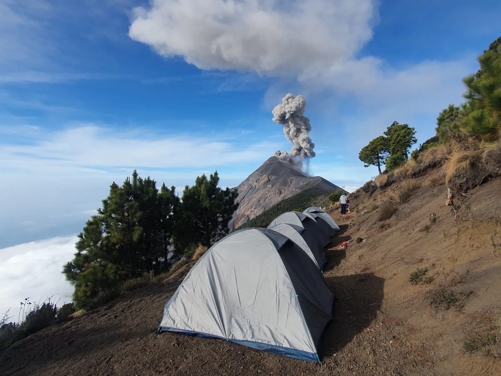
Watching Fuego from an approved camp on Acatenango, with a guide and proper warm gear, is a reasonable risk for a fit hiker; climbing Fuego itself is dangerous and banned. As of November 2026, Fuego erupts every day: INSIVUMEH’s bulletins from 31 October to 12 November logged roughly 1 to 8 explosions an hour. The camps sit on a different mountain, about 3 km from Fuego’s summit across a deep saddle, and the dangers you are most likely to face there are cold, altitude, exhaustion and bad weather. Neither of the two fatal incidents on Acatenango covered below, in January 2017 and August 2026, was blamed on an eruption. Access can close at short notice, so check the official sources before you go, as set out at the end.
Check Availability
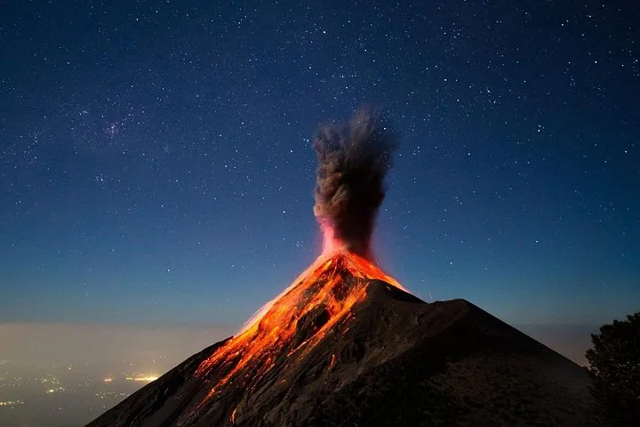
Acatenango Overnight Hike Multiday Tour
- 4.8/5 (330+ reviews)
- 2 days, 1 night
- Operated by CA Travelers
Includes Park admission fee · Lunch, dinner and breakfast · Shared four-person cabin with a 12 cm mattress and pillow
You'll choose your date and complete the booking on Viator.
What can go wrong on an Acatenango overnight
Cold comes first. Model estimates put average lows at Acatenango’s 3,976 m summit at or below 0 °C in every month, and around −2 to −3 °C from November to March; the camps are a little warmer, but strong wind makes them feel colder. On the night of the 2017 deaths, temperatures fell to about −6 °C. Check that your tour includes a sleeping bag rated below freezing, a warm jacket and gloves, and bring a dry base layer and a hat to sleep in.
Altitude is the second risk. The camps sit at roughly 3,400 to 3,750 m, and most groups reach them on the same day they leave Antigua at 1,545 m. The CDC says anyone sleeping at 2,450 m or higher without acclimatizing is at risk of altitude illness. Headache is the main symptom, often with nausea, dizziness, fatigue or loss of appetite. Tell your guide at once if you feel any of these, and go down if they get worse. Confusion, loss of balance or breathlessness at rest need help and descent straight away. A few days in Antigua first can help, but nothing guarantees you will not feel the altitude; if you have a heart, lung or other medical condition, ask your doctor before you book.
Exertion and weather complete the list. You climb about 1,500 m in 4 to 6 hours on loose volcanic sand, and many falls happen on the scree on the way down. CONRED’s advice of 11 November 2026 is to cancel in strong wind, heavy rain, electrical storms or poor visibility, and to stop and ask for help if you feel exhausted, dizzy or nauseous.
Where Fuego’s eruptions can and cannot reach
The 2018 disaster shows where Fuego’s worst hazard goes. On 3 June 2018, pyroclastic flows, fast clouds of hot gas and rock, ran down the Las Lajas ravine on Fuego’s southeastern flank and buried San Miguel Los Lotes and El Rodeo. CONRED figures reported in August 2026 put the toll at roughly 200 people confirmed dead, with more than 200 still missing; some local groups dispute the official count. Those flows hit villages below Fuego, not the Acatenango camps, which stand on another volcano to the north.
The danger zone for hikers lies between the two mountains. La Meseta and El Camellón, the ground on the saddle nearest Fuego, are in range of ballistics, the larger blocks hurled out by strong explosions. INSIVUMEH’s bulletin of 7 November 2026 warned that ballistic material can land more than 500 m around the crater and advised people not to stay on La Meseta or near it. In the rainy season, from May to October, rain can also set off lahars, mud and boulder flows that run down Fuego’s ravines.
Big eruptions still close the area. During the paroxysm of 3 to 5 August 2026, Fuego threw lava fountains of up to about 300 m (per AP), CONRED evacuated about 1,700 people from nearby communities, and the Acatenango park shut until 7 August. No deaths or building damage were reported. The eruption history guide covers 1974, 2018 and 2025 in more detail.
Other Experiences
Other experiences you might enjoy
Guided Acatenango overnight tours from Antigua that camp across the saddle from Fuego, with warm gear and cancellation terms that vary by listing.
Deaths on Acatenango in 2017 and 2026
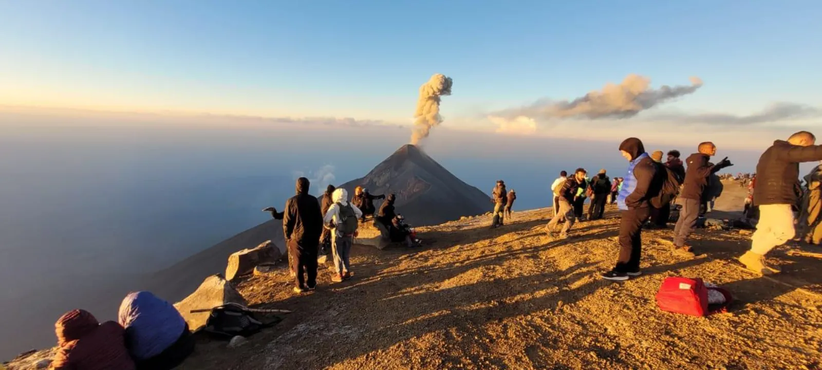
On the night of 7 January 2017, at least six Guatemalan climbers died on Acatenango during a sudden cold spell; some later reports gave seven. Tents were blown down and temperatures dropped to about −6 °C. CONRED blamed a high-pressure weather system and said the climbers were not with a guide and were not equipped for the cold. A few days later, on 13 January 2017, the municipality and INGUAT brought in the park fee and a registration log at the trailhead.
On 3 August 2026, the press reported that a 17-year-old had died while climbing Acatenango. The reports did not give an official cause of death.
Both cases point to the same precautions: go with a guide, carry gear for a night below freezing, and tell your guide early if you feel unwell.
Why closures happen, and the ban on climbing Fuego
Closures follow Fuego’s bigger eruptions. On 3 August 2026, CONRED declared an institutional orange alert; the next day police were posted at the Acatenango entrance and INGUAT told agencies to suspend tours. The municipality reopened the park on 7 August 2026 on previously approved routes only. Ascents were restricted in March 2025 too. No notice lifting the August 2026 alert has been published, and CONRED’s October and November bulletins do not state an alert level, so this guide does not print a current alert color.
Climbing Fuego is a separate matter: it is banned at all times. The Municipality of Acatenango banned the route through its park on 1 April 2026. On 25 June 2026, CONAP, CONRED and INGUAT jointly said that climbing Fuego is prohibited because of its eruptions and called tours promoted online illegal, and CONRED repeated on 9 August 2026 that the ascent is not authorized. Some listings still sell an extra hike toward Fuego from camp; do not book it. The 2026 ban explained lists the warning signs.
Crime, the US advisory and emergency numbers
The US State Department rates Guatemala Level 3, “Reconsider Travel,” for crime and terrorism (as of March 2026). Its “Do Not Travel” areas are San Marcos, Huehuetenango, Zone 18 of Guatemala City and Villa Nueva; none is on the drive from Antigua to the La Soledad trailhead. In Antigua, local guides advise visiting the Cerro de la Cruz viewpoint in daylight because of past robberies on the access path; tourist police patrol it. Leave valuables in your hotel or with your operator’s luggage storage.
Save these numbers before you go: 1500 for INGUAT’s tourist assistance line (24 hours, English and Spanish), 119 for CONRED, 110 or 120 for police, 122 or 123 for firefighters and ambulance, and 125 for the Red Cross.
Insurance and choosing a well-equipped tour
Buy travel insurance that covers hiking to about 4,000 m and emergency evacuation, and check whether it pays out when a natural event closes the park. Cancellation terms differ by listing. GetYourGuide listings on this site allow free cancellation up to 24 hours before, while some Viator listings are final sale.
Gear matters more than bed type for your safety. CA Travelers’ overnight includes the park fee, a sleeping bag rated to −6 °C with a liner and extra blanket, a loaned winter jacket and gloves, a first aid kit and a 3-liter Camelbak of water, with four people to a cabin. It costs from US$129 per person and is rated 4.8/5 from 330+ reviews on Viator. The listing does not advertise the banned Fuego add-on. Bookings are final, with no refund if you cancel, and Viator shows no departures from 24 December 2026 to 1 January 2027 (our review). We earn a commission if you book through our links, at no extra cost to you. To compare every option, see the Acatenango tours facing Fuego.
How to check conditions before you go
Check three sources in the 48 hours before your hike and again the evening before. INSIVUMEH publishes a daily Fuego bulletin, usually early in the morning Guatemala time, which you can follow on the page tracking Fuego’s activity today. CONRED posts alerts, closures and advice at conred.gob.gt. Your operator hears about closures at the gate first, so ask on WhatsApp whether the park is open and which camp you will use. A bulletin tells you what Fuego did; it is not a safety clearance, so treat any new alert, closure notice or storm forecast as a reason to call your operator before you leave Antigua.
Frequently asked questions
Is it safe to watch Fuego erupt from Acatenango?
For a fit hiker with a guide and warm gear, the risk is reasonable. The camps sit about 3 km from Fuego’s summit on another mountain. The main dangers there are cold, altitude, exhaustion and weather.
Can you climb Fuego?
No. The Municipality of Acatenango banned the route on 1 April 2026, and CONAP, CONRED and INGUAT have said climbing Fuego is prohibited. Do not book listings that still sell a Fuego hike.
Has anyone died hiking Acatenango?
Yes. At least six Guatemalan climbers died in a cold spell on 7 January 2017, and a 17-year-old died while climbing in August 2026, with no official cause given in press reports. Neither was blamed on an eruption.
Did the 2018 eruption reach the Acatenango camps?
No. The pyroclastic flows of 3 June 2018 ran down the Las Lajas ravine on Fuego’s southeastern flank and buried villages there, killing roughly 200 people according to CONRED, with more than 200 missing.
What is Fuego’s alert level now?
CONRED declared an orange alert on 3 August 2026, no notice lifting it has been published, and its October and November 2026 bulletins state no level. Check conred.gob.gt for the current position.
Is Guatemala safe for tourists?
The US State Department rates Guatemala Level 3, “Reconsider Travel” (as of March 2026). Its “Do Not Travel” areas are not on the Antigua to Acatenango route. Keep valuables in Antigua and save the 1500 tourist line.
Pick Your Night Facing Fuego
The A-frame cabin overnight is rated 4.5 from 1,040+ reviews on GetYourGuide, with free cancellation up to 24 hours before. Check Fuego's latest activity and the park status the day before you go.
Check Dates & Tour Options